Good Friday bloggers,
We had a fantastic Friday sunrise and before the sunrise we were able to see the moon and Venus rising.
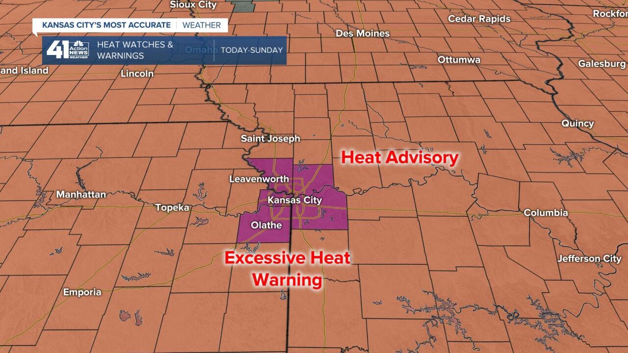
We are in an Excessive Heat Warning today through Sunday, but wind will help a bit and a cold front is showing up by the end of the weekend. Only the KC area is in an Excessive Heat Warning as the concrete of the city holds more heat. A Heat Advisory is in effect everywhere else. The bottom line...It is going to be hot and very humid the next 3 days.
Let's go through this forecast. We will start with the heat and end with a cold front.
TODAY: There will be some afternoon clouds as a disturbance moves in from the southwest. We will still see highs 94-97 with heat index values 100-103. A south breeze 10-20 mph will help a bit.

TONIGHT: Lows will struggle to drop below 80. There will be a bit of a breeze and there may even be a few showers and thunderstorms.
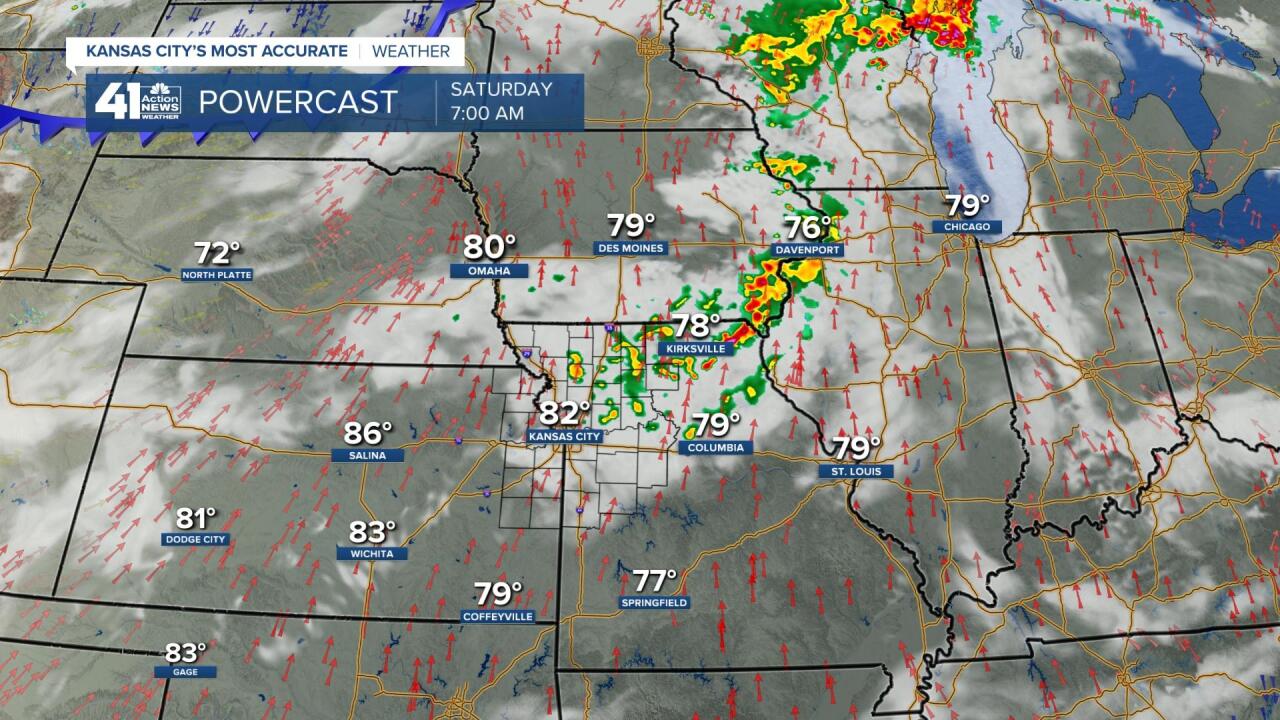
SATURDAY: This looks like the hottest day of the summer, so far, and also the hottest day of this hottest stretch. Highs will be in the mid to upper 90s with heat index values 102-108. A south wind at 15-30 mph will help some.

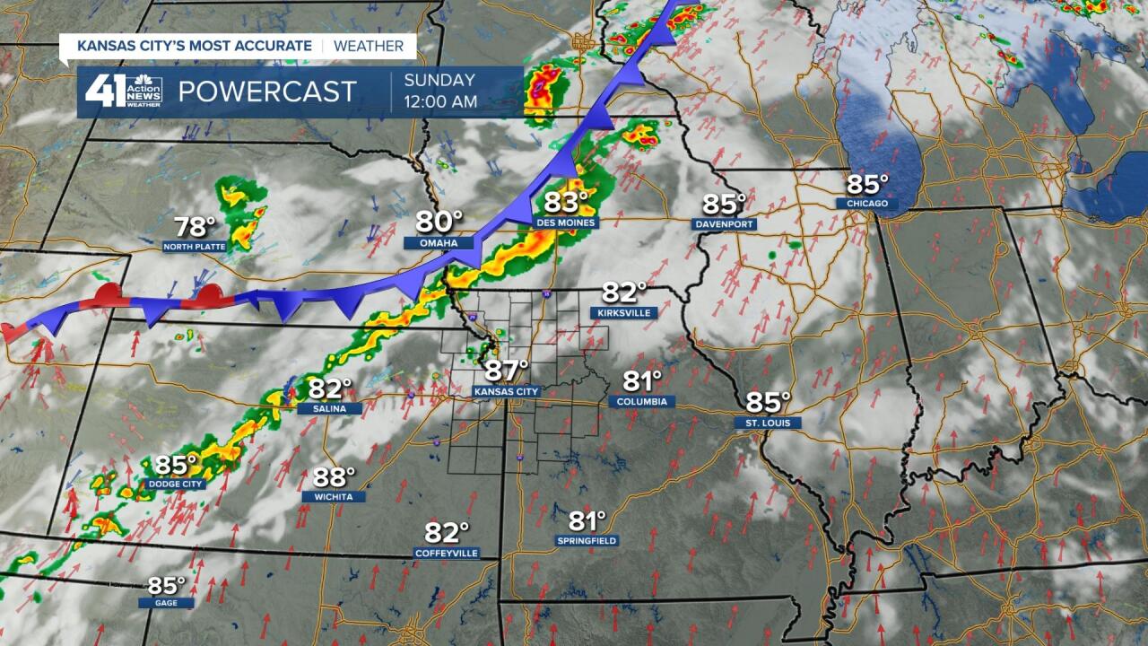
SATURDAY NIGHT-SUNDAY: A few thunderstorms will be possible as a cold front approaches. This is a map valid Saturday night at midnight. Lows will be 75-80 and highs Sunday will be 90-95 along with out of control humidity. The wind will be less, but clouds may help a bit.
Here is a look at the satellite picture from early Friday morning. The pattern is one which the heat will have a hard time being sustained in our area. Here is why.
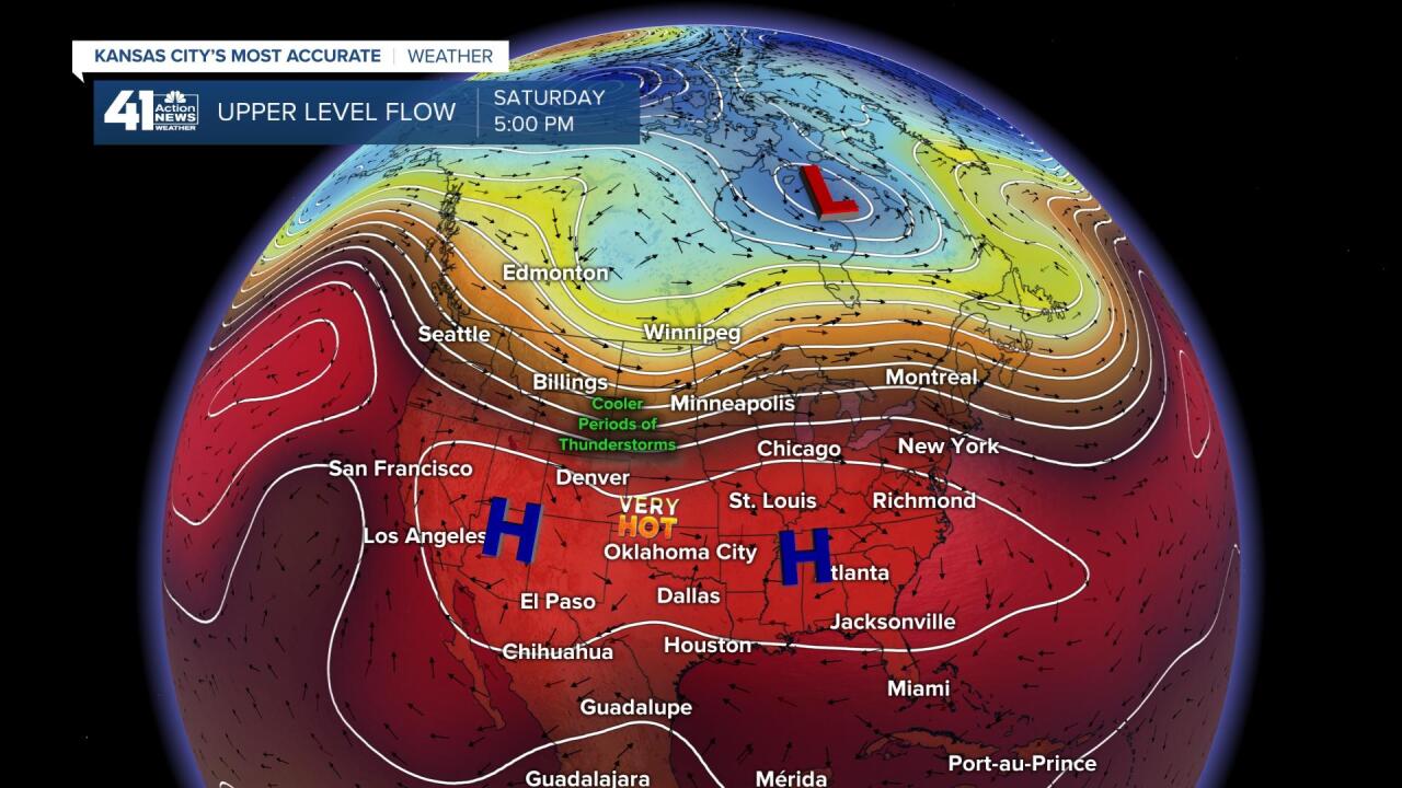
The "Heat wave creating machine" also known as an upper level high is centered over Texas. We are barely under its influence. There are countless disturbances tracking north out of Mexico into the southwest USA. These are increasing the southwest Monsoon. This happens every summer and brings rain to some very dry areas. The weather pattern is set up to bring these east out into the Plains and Midwest. Once the disturbances make it out into the Plains the gather the thicker moisture and create larger clusters of thunderstorms, an MCS (Mesoscale Convective System).
As the disturbances track out of the Rockies, big storm systems tracking east across Canada send cold fronts south every 2-3 days. The fronts and disturbances link up and can create even bigger thunderstorm clusters. This is what happened Wednesday. And, this may happen Sunday night-Tuesday.

UPPER LEVEL FLOW SATURDAY: The main heat wave creating machines are located from the southwest to southeast USA. We are on the northern fringe of influence from the upper level highs as the jet stream is sagging south.
UPPER LEVEL FLOW MONDAY: The upper level highs have split in two and the jet stream has sagged into the region. So, we are in the thunderstorm part of the pattern and the heat gets shoved south. The front that comes south Sunday will waver back and forth through Tuesday-Wednesday of next week.

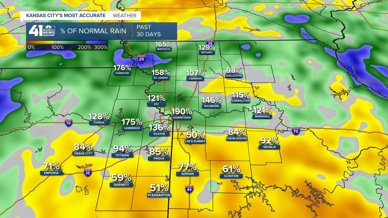
The rain on Wednesday did wonders. The percent average rainfall for the last 30 days is now over 100% for most locations north of I-70. Locations south of I-70 still need the rain and even areas to the north will need some rain after these hot days. The topsoil dries out fast this time of year.
RAINFALL FORECAST THE NEXT 5-7 DAYS: Most locations will see at least 1"-3" of rain and we know, like last Wednesday, some will see much more and too much of a good thing. Hopefully, the areas south of I-70 get the rain this time. The main rain chances start Sunday night.

Have a great weekend and stay healthy.
"front" - Google News
July 17, 2020 at 08:51PM
https://ift.tt/3j7K7W9
Weather Blog: Excessive Heat Warning and a Cold Front - KSHB
"front" - Google News
https://ift.tt/3aZh1mr
https://ift.tt/3b2xvu5


No comments:
Post a Comment